Rongai Route – Mount Kilimanjaro
Rongai Route – Mount Kilimanjaro.
DAY 1
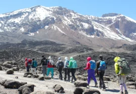
We get to Rongai after going through the registering process at the Marangu National Park gate. A small path leads from Nale Moru (1,950 m) to the start of the climb. The path goes through fields of potatoes and maize before joining a pine forest. The trail then starts to steadily rise through a beautiful forest that is home to many animals, including the stunning Kilimanjaro Colobus monkey. The monkeys are black, and their white hair grows out into a long “cape.” Their white tail flows down. As you go higher, the jungle starts to thin out. The first camp, Rongai One, is on the edge of the moorland zone (2,600 m) and has a great view of the Kenyan plains. [walking for 3–4 hours]
DAY 2
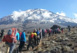
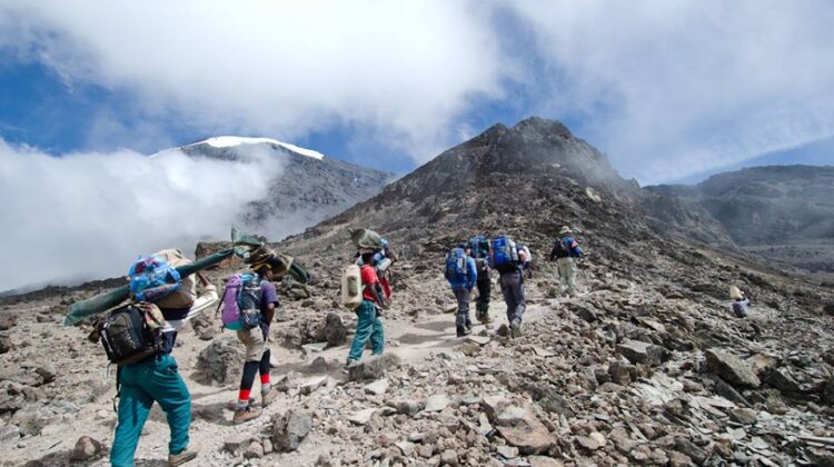
The walk in the morning is a steady climb up to the “Second Cave” (3,450 m), from which there are great views of Kibo and the Eastern icefields from the edge of the crater. After lunch, we leave the main track and take a smaller path across the moors to get to Mawenzi’s sharp peaks. Near Kikelewa Caves (3,600 m), the Kikelewa campsite is in a valley with big senecios that is well protected. It takes about 6-7 hours to walk there.
DAY 3
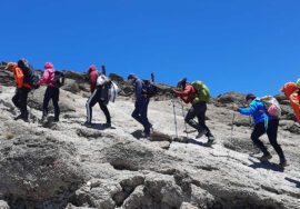
You can get great views all around and a real sense of being in the wilderness after a short but steep hike. We leave the plants behind not long before we get to the next camp at Mawenzi Tarn (4,330 m), which is in a beautiful cirque right below the tall towers of Mawenzi. You can rest or tour the area in the afternoon to help your body get used to the altitude. [walking for 3–4 hours]
DAY 4
Between Mawenzi and Kibo, there is a lunar desert called the “Saddle.” We cross it to get to the Kibo campsite, which is 4,700 meters below the crater wall of Kibo. The rest of the day is spent resting to get ready for the last climb before a very early night! (walking for 5–6 hours)
DAY 5
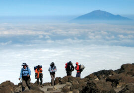
Around 1 a.m., we will start the last part of the climb by torchlight. It is by far the steepest and hardest part. To get to Gillman’s Point (5,685 m), the edge of the crater, we walked very slowly on a switchback path through loose volcanic scree in the dark. We will take a short break there to enjoy the beautiful sunrise over Mawenzi. If you are still feeling good, you can make the three-hour round trip to Uhuru Peak (5,896 m), where you will see the beautiful glaciers and ice cliffs that still cover most of the summit area. It goes down surprisingly quickly to Kibo (4,700 m), and after a break to re-energize, we keep going down to reach Horombo Camp (3,720 m). (11 to 15 hours walking)
DAY 6
We keep going down through moorland until we reach Mandara Hut (2,700m), which is the first stop on the Marangu path. Then we keep going down on a good road through a beautiful, lush forest until we reach the National Park gate at Marangu, which is 1,830 m above sea level. (walking for 5–6 hours)
It’s not just Tanzania that we know!
If you want to know more about Tanzania, the best thing to do is call us during business hours. We really enjoy Tanzania, but we also really enjoy the rest of Africa. We have experts in all of the big safari countries. If you’re not sure where to go, please email or call us!